The Clyde Walkway Stage 4: Cardies Bridge to Crossford
Through historic woodlands and agricultural landscape to Crossford village.
This 6 mile section starts at the southern end of Cambusnethan Woodlands and passes through a varied woodland and agricultural landscape as far as Crossford village.
Start / park: You can join the Clyde Walkway at this section by parking at Mauldslie Woodlands or Law. Park at Mauldslie Woodlands, using the informal parking across the bridge to the woodlands off the A72 between Rosebank and Dalserf. Park in Law using the car park on Station Road, Law, ML8 5JA. The car park is situated between Lawmuir Road and Shawfield Crescent, beside the bus stop and public toilet.
You can do the trail backwards by starting in Crossford or Carluke.
Public Transport: Bus and other local services are available in Law village, which lies approximately 20 minutes walk from Mauldslie Castle Estate, where you can join the trail.
If you are doing the trail backwards, buses to Hamilton and Lanark pass through Crossford. Rail services to Glasgow and beyond are available in Carluke, three miles north of Crossford.
Check the Traveline Scotland widget on the right for details on the frequency of services.
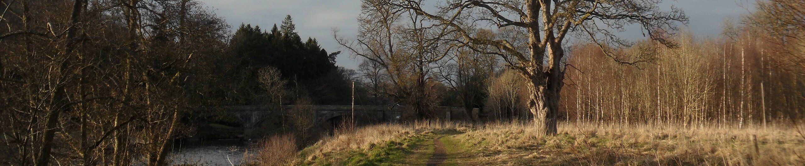
34. Cardies Bridge
From Cardies Bridge, the path follows the course of Garrion Burn downstream through West Brownlee Wood before meeting the River Clyde.
The Walkway then continues upstream along the Clyde passing through Mauldslie Woodlands and accompanying parkland which comprises part of the former Mauldslie Castle Estate. In 2007 Scottish Natural Heritage designated both West Brownlee and Mauldslie Woods part of the newly created Clyde Valley Woodland National Nature Reserve (NNR). The woodlands are managed by South Lanarkshire Council for public access, nature conservation and landscape objectives.
Mauldslie Castle itself was demolished in the 1930’s although a number of former estate buildings remain which have been converted into residential properties.
35. Mauldslie Bridge
Continue through the parkland along the bank of the Clyde as far as Mauldslie Bridge from where there is access onto the A72 Clyde Valley National Tourist Route.
36. Detour: Dalserf Kirk
At this point, a short diversion can be made back along the A72 to the small settlement of Dalserf. The village is dominated by Dalserf Kirk a traditional Scots country church, erected in 1655 during the early days of Presbyterianism and the 'Covenanters'. The churchyard contains a number of interesting and very old gravestones.
A short distance in the opposite direction along the A72 from Mauldslie Bridge is the village of Rosebank where there are local services and facilities.
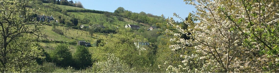
The village was designed and built to house the Mauldslie Castle estate workers. This part of the Clyde Valley has been a fruit growing area since medieval times, with dozens of different varieties of apples and pears being grown. Most of the surviving orchards, which are at their most impressive during April and May when the blossom is at its best, now grow Victoria plums.
37: Crossford Bridge
From Mauldslie Bridge, the Walkway continues along the bank of the Clyde through the estate parkland and Jock’s Burn woodland, a Site of Special Scientific Interest (SSSI) and also part of the Clyde Valley Woodland National Nature Reserve, before crossing Jock’s Burn at its confluence with the Clyde.
The Walkway continues a little way from the river past the derelict remains of Burnetholm cottage and through the woodlands of the Milton Lockhart Estate, along a newly constructed and well signposted section of route which was completed in 2008.
There are a series of ascents and descents as the route meanders through the woods, crossing the estate road along the way, with views of the valley and surrounding countryside at various points.
The woods are rich in wildlife and are ablaze with blue bells in spring. The path emerges from the woodlands and continues upstream through fields along the north bank of river crossing Townhead Burn along the way.
Please be aware that as some sections of the route are not fenced off and the fields may contain livestock you are asked to keep dogs under strict control at all times.
The route then crosses an un-named burn and ascends a steep bank by way of a flight of timber steps before passing by Waygatehaw House parts of which dates back to the 15th Century and onto Poplar Glen. The route continues along the river bank through agricultural land, passing by Orchard House, and its 18th century Italianate style designed terraced gardens (private) before crossing the Mashock Burn and continuing as far as Crossford Bridge where the path emerges on to the B7056 (Braidwood Road).38. Detour: Craignethan Castle
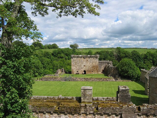
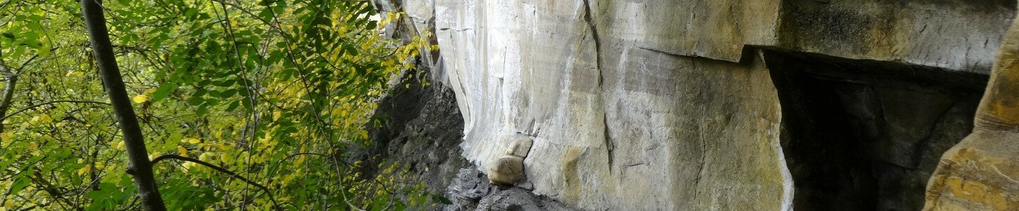
At this point it is possible to take a detour to Craignethan Castle by way of Scottish Wildlife Trust’s Lower Nethan Gorge nature reserve, which is also part of the Clyde Valley National Nature Reserve.
Cross Crossford Bridge and turn right onto the A72. The entrance to the nature reserve is located approximately ¼ mile along the road on the left hand-side.
Follow the well defined route through the spectacular wooded gorge to the castle. Craignethan Castle, which is in an exceptional state of preservation, dates from the first half of the 16th century.
It is famously known as providing the prototype for the castle ‘Tillietudlem’ in Sir Walter Scott’s novel ‘Old Mortality’. It is also reputed that Mary Queen of Scots, whose ghost allegedly still haunts the building, spent her last night of freedom at the castle.
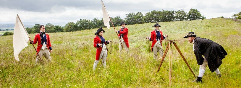
39. Detour: Major General William Roy's Birthplace
An alternative detour from Crossford is a visit to the birthplace of surveyor and cartographer Major General William Roy (1726 - 1790).
Following the Jacobite rebellion, Major Roy was directed to produce a map of Scotland to enable more effective policing of the country. The hand drawn map that he produced between 1747 and 1755 can still be seen in the British Library.
Roy was later commissioned to set up the network on which all subsequent map surveying was based. It was his vision of an organisation responsible for mapping and surveying in the United Kingdom which resulted in the establishment of the Ordnance Survey a year after his death.
From the Clyde Walkway at Poplarglen, continue uphill on the minor road past Waygateshawhead Farm, turn left at the T-junction and continue past Meadowhead Farm to Milton Road Turn left at the junction and continue along the road for approximately ½ mile. An ordnance survey triangulation pillar on the right-hand side of the road marks the site of General Roy’s birthplace.
*To take a direct route to Carluke railway station from this point, retrace your steps along Milton Road, taking the first left onto Station Road and continuing on past Glenburn to the station.Alternatively, 400 yards along Milton Road from the memorial turn left through the gate onto the waymarked right of way to Jock’s Gill Wood continue through the woodland following the course of Jock’s Burn upstream back onto Station Road at Glenburn.
End: Please respect the Scottish Outdoor Access Code . Scotland’s outdoors is managed by a variety of people and organisations and many of them earn their living from the land. It is all of our responsibilities to respect each other’s activities and interests in the outdoors. As with all outdoor activities walking can present hazards. It is the access-taker’s responsibility to judge whether they can take access safely in any given situation. This route guide does not give any guarantee of path conditions.
(!) Some sections of the Clyde Walkway pass close to or through areas of natural hazard such as cliffs, deep & fast flowing water, steeply sloping and uneven ground. Please keep to the path and ensure that children and dogs are kept under close control. Stay safe and enjoy your visit.


